- Screen Colours:
- Normal
- Black & Yellow
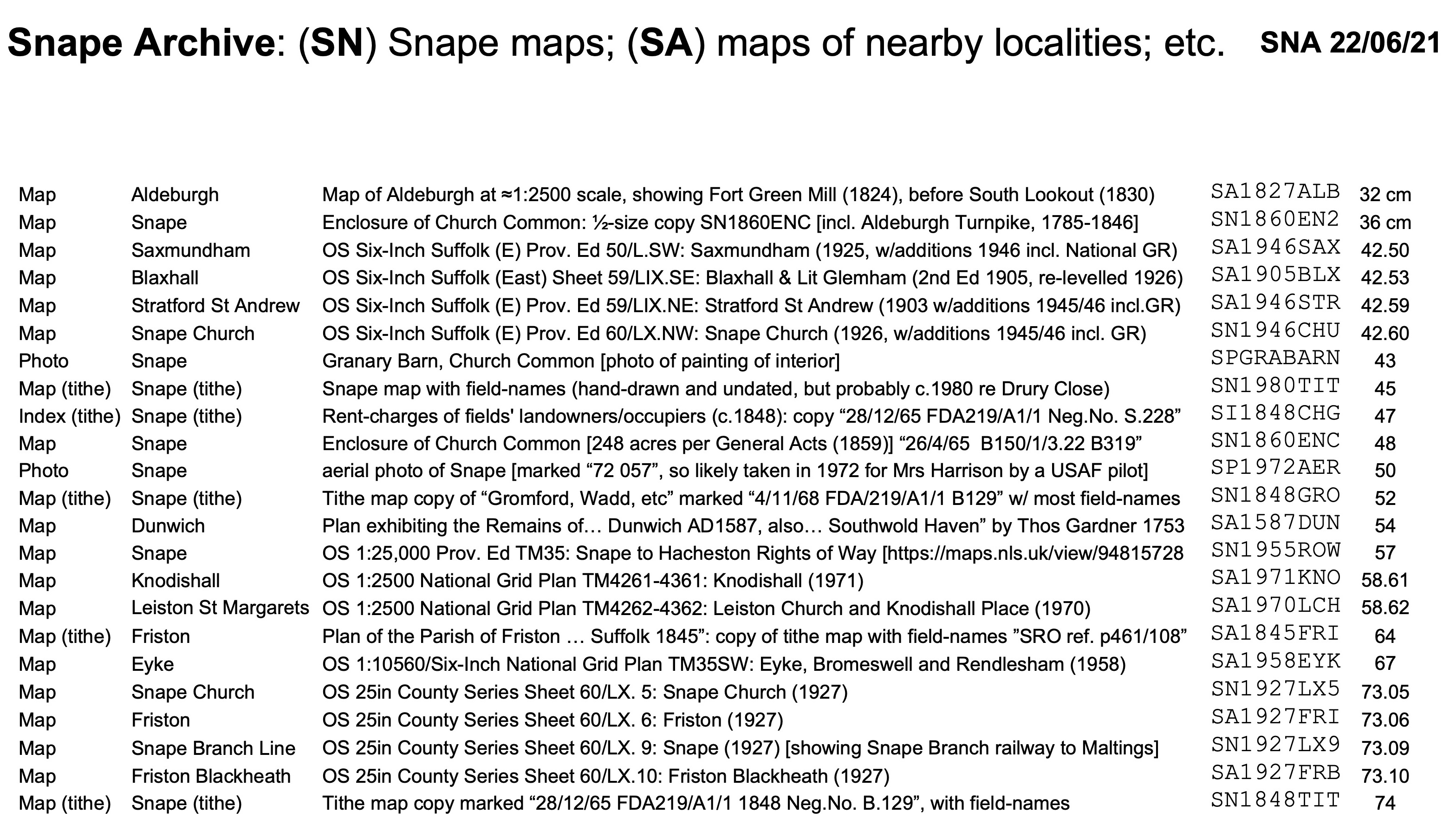
The resources of the Snape Archive comprise several documents, mostly large flat maps of Snape Parish and surrounding villages. Amongst them are tithe maps prepared in the 1960s and 70s by the Snape History Group, led by Mrs Mary "Muffet" Harrison (1912-1999) of Snape Hall, who had the foresight to hand-annotate each field-name, so that it wouldn't be corrupted or even forgotten. (Mrs Harrison's Snape Historical Trust was also intimately involved with the 1985-90 excavations at Snape Anglo-Saxon Cemetery, featured on our Village Sign.)
The documents have been carefully reflattened, and repaired as necessary. For safe keeping, the Collection (listed below) is held in a map-chest to which the Alde Valley Suffolk Family History Group (AVSFHG), based in Leiston, has ready access. They are filed in order of height (and including a few by map-series number too), with the smallest at the front, as indicated in the last column below. Any/all of these flat documents can be promptly returned to Snape and viewing arranged on email request to recorder@SnapeVillage.info .
You can click on the image above to download a copy.
Most of the OS maps above can also be viewed online on the National Library of Scotland website — and indeed ordered from them.
You can email webmaster@snapevillage.info for a list of hyperlinks to be sent to you.
| The AVSFHG has a large collection of old Suffolk maps and other, mostly local, historical records — see their website for more details. | ||||||
| The maps there include the following of especial Snape interest (which can also be viewed on request, as explained above) — | ||||||
| OS 1:2500 National Grid Plan TM3859-3959: Snape Church (1975) | OA SNA CH 75 | ≈A1 | ||||
| OS 1:2500 National Grid Plan TM3858-3958: Snape (1975) | OA SNAPE 75 | ≈A1 | ||||
| OS 1:2500 National Grid Plan TM3857-3957: Snape Maltings (1975) [shows railway track-bed] | OA SNA MALT | ≈A1 | ||||
| OS Six-Inch Suffolk (East) Sheet 60/LX.SW: Friston, Iken, Snape and Tunstall (1884) [repro] — also view it online here | SLS SN LXSW | ≈A2 | ||||
Several other maps are accessible digitally on/from this (Snape) website.
